AccuWeather’s early outlook suggests that 2026 will likely see fewer storms than the 10-year average. However, “below average” does not mean “low risk.” Experts are specifically concerned about the central and eastern Gulf coast, where risks for significant impacts are trending higher than historical norms.
2026 Prediction Totals
| Category | AccuWeather Forecast |
| Named Storms | 11 – 16 |
| Total Hurricanes | 4 – 7 |
| Major Hurricanes (Cat 3+ ) | 2 – 4 |
| Direct U.S. Impacts | 3 – 5 |
The Climate Tug-of-War: El Niño vs. Warm Water
The 2026 season is being shaped by two competing forces:
-
The Stabilizer (El Niño): There is a 15% chance of a “Super El Niño” developing. This pattern typically creates wind shear that “chops off” the tops of developing storms, potentially suppressing activity later in the summer.
-
The Fuel (Warm Water): Atlantic and Gulf water temperatures are already exceptionally warm—and that heat extends hundreds of feet deep. This creates a high risk for rapid intensification, where storms gain strength at a terrifying pace just before making landfall.
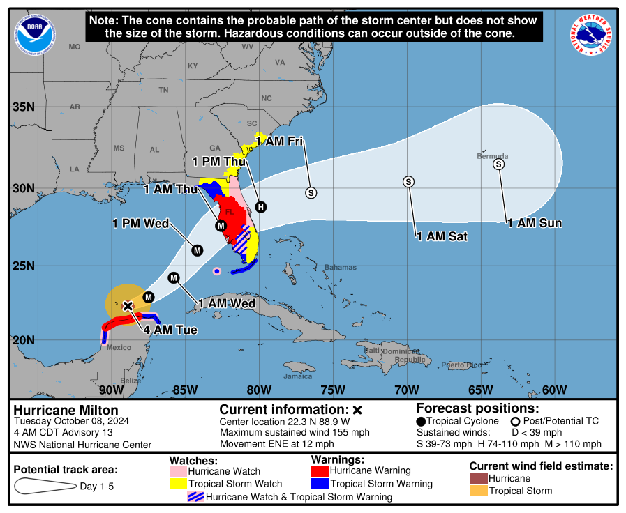
New for 2026: An Improved “Hurricane Cone”
The National Hurricane Center (NHC) is rolling out a major update to the iconic “forecast cone” this year. After a successful experimental phase, the new graphic is designed to better communicate risks to those who don’t live directly on the beach.
What’s changing on the map:
-
Inland Visibility: The cone will now show tropical storm and hurricane watches and warnings for inland areas, not just coastal lines.
-
Streamlined Shading: The 5-day outlook will now use a single shading style for better clarity.
-
Combined Alerts: New symbols will indicate where both a hurricane watch and a tropical storm warning are in effect simultaneously (marked by diagonal pink and blue lines).
The Risk of “Homegrown” Storms
Forecasters are issuing a specific warning about “homegrown” development—storms that form in the Gulf or western Atlantic very close to the U.S. coast. Unlike storms that trek across the ocean from Africa for a week, these spin up in a matter of days, leaving residents and businesses with significantly less time to react and evacuate.
Preparation Checklist for 2026
-
Review Insurance: Ensure your wind and flood policies are active (remember the 30-day waiting period for NFIP).
-
Stock Supplies: Avoid the “empty shelf” rush by gathering water, batteries, and non-perishables now.
-
Know Your Zone: Even if you aren’t on the coast, the new NHC cone highlights that wind and rain hazards are an inland reality.
-
Stay Informed: Follow local updates and pay attention to the new watch/warning layers on the forecast cone.