Skip to the content
LeAneSUAREZgroup
  • Home
  • Listing
    • Advanced Search
    • Featured Listings
    • Rental Concierge
  • Communities
    • Captiva Island
    • South Seas Resort
    • Fort Myers
    • Fort Myers Beach
    • Bonita Springs
    • Cape Coral
    • Naples
    • Marco Island
  • Our Story
    • Real Estate
    • SUAREZFamilyofCompanies
    • Construction
    • List with Us
    • Offices
    • Testimonials
  • Resources
    • The Coastline Journal
    • SWFL Market Report
    • SWFL Golf Guide
    • Christie’s Luxury Living Magazine
    • COMMUNITY PARTNERS
    • HomeLook Magazine
    • SANIBEL & CAPTIVA WEBCAMS
    • Local Weather Forecast
    • CAPTIVA ISLAND INFORMATION
    • SANIBEL ISLAND INFORMATION
    • BUYING
    • SELLING
    • FIRPTA – INFO
    • 1031 TAX DEFERRED EXCHANGE
    • COMMUNITY PAGE
  • Sign Up
  • Login
My Account

Erin Becomes First Hurricane of the Atlantic Season

The 2024 Atlantic hurricane season officially began in June, but it wasn’t until Thursday, Aug. 15 that the season’s first hurricane formed. At 11 a.m., Tropical Storm Erin was officially upgraded to a hurricane by the National Weather Service.

Just two days earlier, on Aug. 13, Erin was located about 890 miles east of the Northern Leeward Islands with maximum sustained winds of 60 mph. Forecasters predicted a west-northwest track, bringing the storm near or just north of the Northern Leeward Islands over the weekend.

Forecast & Potential Strength

Meteorologists from the National Oceanic and Atmospheric Administration (NOAA) and AccuWeather expect Erin to intensify quickly. Atmospheric and oceanic conditions northeast of the Lesser Antilles are favorable for rapid strengthening, potentially making Erin a major Category 3 hurricane by Saturday.

AccuWeather experts note there is even a chance Erin could reach Category 4 status this weekend or early next week. The system is expected to bring heavy rain, damaging winds, and dangerous surf to the Leeward Islands and Puerto Rico.

U.S. Impact: Low Risk for Now

Current weather models show Erin continuing on a west-northwest path before curving north, avoiding a Florida landfall. However, The Weather Channel reports that the exact point of the northward turn remains uncertain.

While the probability of U.S. East Coast landfall is currently low, coastal areas should monitor updates closely. Regardless of the exact track, Erin will generate high surf and dangerous rip currents along the East Coast next week.

Local Weather in Southwest Florida

Southwest Florida has already been experiencing a wet August. In the first two weeks alone:

  • Agualinda Water Plant (Cape Coral): 5.53 inches of rain

  • Bowman’s Beach (Sanibel): 14.44 inches, nearly 10 inches in just the last five days

  • St. James City: 11.34 inches

For reference, the average August rainfall for Lee County since 1992 is 9.69 inches, meaning many areas are already at or above their monthly average.

Florida Governor Ron DeSantis reassured residents on Aug. 13 via X, stating:

“Models for Hurricane Erin currently have it turning north and staying far away from Florida. We continue to monitor for any shifts.”
RECENT BLOGS

Camino de Sanibel registration

Get Ready: Camino de Sanibel Registration Opens Nov. 2 for 2027 Walk

October 30, 2026 No Comments

The highly anticipated Camino de Sanibel registration opens Nov. 2, offering residents and visitors a deeply moving opportunity to cross the entire barrier island on

Read More »
By the Sea Condominiums Sanibel 2026

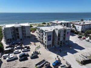
Milestone Reached: By the Sea Condominiums Sanibel 2026 Rebuild Ahead of Schedule

October 30, 2026 No Comments

A major construction milestone was celebrated last week on the barrier islands as the By the Sea Condominiums Sanibel 2026 redevelopment project officially reached its

Read More »
JOG N JAM

JOG N JAM 2026: Run, Rock, and Give Back in Sanibel

October 30, 2026 No Comments

The JOG N JAM is officially returning to the Gulf coast next month, and this highly anticipated annual tradition promises to be bigger and better

Read More »
Generosity Breakfast

Generosity Breakfast: 2026 Sanibel Milestone Celebrating Giving

October 30, 2026 No Comments

The Generosity Breakfast is officially returning to Sanibel Island this November. Hosted by the Charitable Foundation of the Islands (CFI), this highly anticipated event honors

Read More »
Sanibel Holiday Arts & Craft Fair

Festive Treasures: Experience the 2026 Sanibel Holiday Arts & Craft Fair

October 30, 2026 No Comments

The most wonderful time of the year is officially arriving along the Gulf coast, and there is no better way to kick off the festive

Read More »
Legacy Harbour Marina

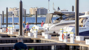
$15 Million Triumphant Return: Legacy Harbour Marina Reopens in Fort Myers

October 30, 2026 No Comments

The highly anticipated reopening of Legacy Harbour Marina in Fort Myers marks a monumental milestone for the local boating community and Southwest Florida’s economic resilience.

Read More »

DISCOVER

  • Home
  • Curated Collection
  • Communities
  • The Journal
  • Contact

CONTACT

LeAne Taylor Suarez

+1 239.872.1632

LeAne@LeAneSUAREZ.com

Aleczander M Suarez

+1 239.322.0243

Alec@LeAneSUAREZ.com

CAPTIVA OFFICE

11499 Andy Rosse Lane
Captiva Island, FL 33924

SANIBEL OFFICE

1019 Periwinkle Way
Sanibel, FL 33957

INSIDER ACCESS

Join our inner circle for market previews and SWFL news.

SFOC Logo

LeAneSUAREZGroup

Refining the art of coastal living from Captiva to Naples.

Christie's Masters Circle 2026

© 2026 LeAneSUAREZGroup. All Rights Reserved. | Privacy Policy